Dholavira is one of the five largest cities of the Harappan — or Indus Valley — civilisation, and the best preserved. It stands near the village of the same name on Khadir Bet, an island of raised ground in the Great Rann of Kutch. Local people knew the mound as Kotada, “the big fort”. This guide covers the story, the visit and the practicalities.
A short history
People first settled here around 3000 BCE. Over the following centuries the settlement grew into a planned, fortified city, reaching its height between about 2600 and 2000 BCE, when the Harappan world stretched from Afghanistan to Gujarat and traded with Mesopotamia. Dholavira prospered on that trade — it lay between the Indus heartland and the coast — and on the working of beads, shell and copper.
Archaeologists divide its life into seven stages. The early ones show the city being laid out and enlarged; the middle ones its prime, with monumental gateways and the great reservoirs; the later ones a slow decline as the climate dried and long-distance trade failed. After a period of abandonment a smaller community returned and built round houses on the ruins. By about 1500 BCE the site was deserted for good.
The mound was recognised as Harappan in the late 1960s by J. P. Joshi of the Archaeological Survey of India. Large-scale excavation began in 1990 under R. S. Bisht and continued for some fifteen years, revealing a city unlike the brick-built ones of the Indus plain: built of stone, laid out in three parts instead of two, and organised around water. On 27 July 2021 UNESCO inscribed “Dholavira: a Harappan City” on the World Heritage List — India’s fortieth World Heritage Site, and the first site of the Indus civilisation in India to be listed.
What makes Dholavira different
- Stone, not brick. Sandstone and limestone masonry survives where brick would have crumbled, so gateways, drains and tanks keep their shape.
- Three-part plan. A citadel (castle and bailey), a middle town and a lower town, all inside an outer wall about 770 m by 620 m.
- Water engineering. Sixteen or more reservoirs, dams on two seasonal streams and a web of storm drains in a place with no river.
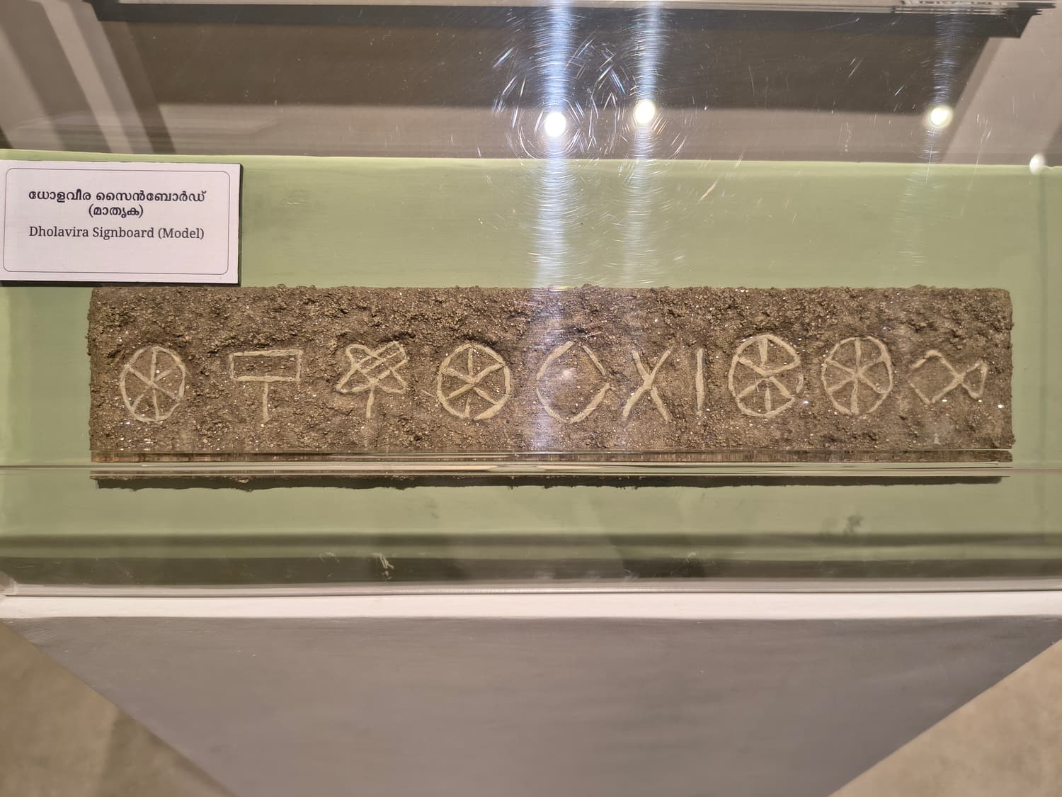
- The signboard. Ten large Indus signs from the North Gate — one of the longest and by far the biggest Indus inscriptions known.
- A ceremonial ground. A level arena nearly 300 m long with stepped stands.
- A strange cemetery. Memorial graves without bodies, and stone-built hemispherical mounds.
A walking route round the site
Allow two to three hours, starting as early as you can.
- 1. The museum (if open): twenty minutes with the model, the seals and the signboard reconstruction. Dholavira Museum.
- 2. The eastern reservoir: the first big structure on the path, with its thirty steps. The Reservoirs.
- 3. The East Gate and the castle: climb through the gate, see the pillar bases, the well and the tanks, and take in the view. The Citadel.
- 4. The North Gate and the stadium: where the signboard was found, looking down on the ceremonial ground. North Gate, Signboard & Stadium.
- 5. The middle and lower towns: streets, houses and the late round huts. Middle & Lower Town.
- 6. The southern reservoirs: loop back below the castle’s south wall past the rock-cut tanks.
 The Harappan city
The Citadel
The fortified castle and bailey at the top of the city
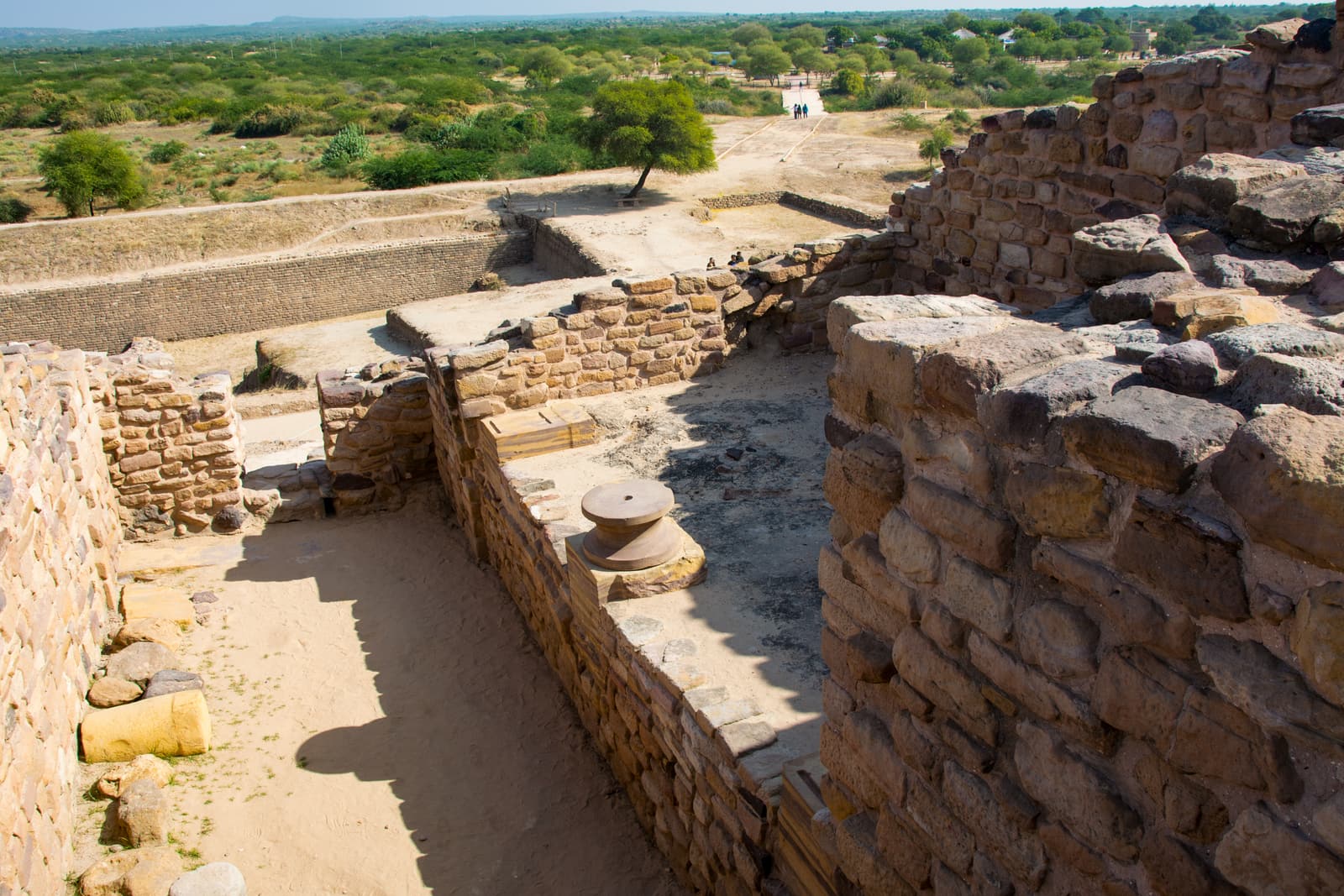
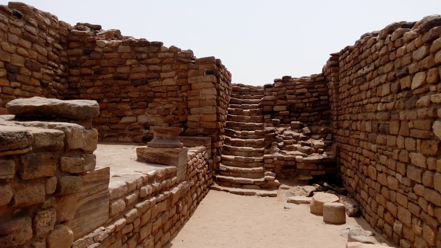
The highest and most heavily defended part of Dholavira: a walled “castle” with a lower “bailey” beside it, entered through monumental gates on the north and east. Inside are wells, tanks, stone drains and the polished pillar bases that mark this out as the seat of whoever ran the city.
 The Harappan city
The Reservoirs
The water system that kept a desert city alive
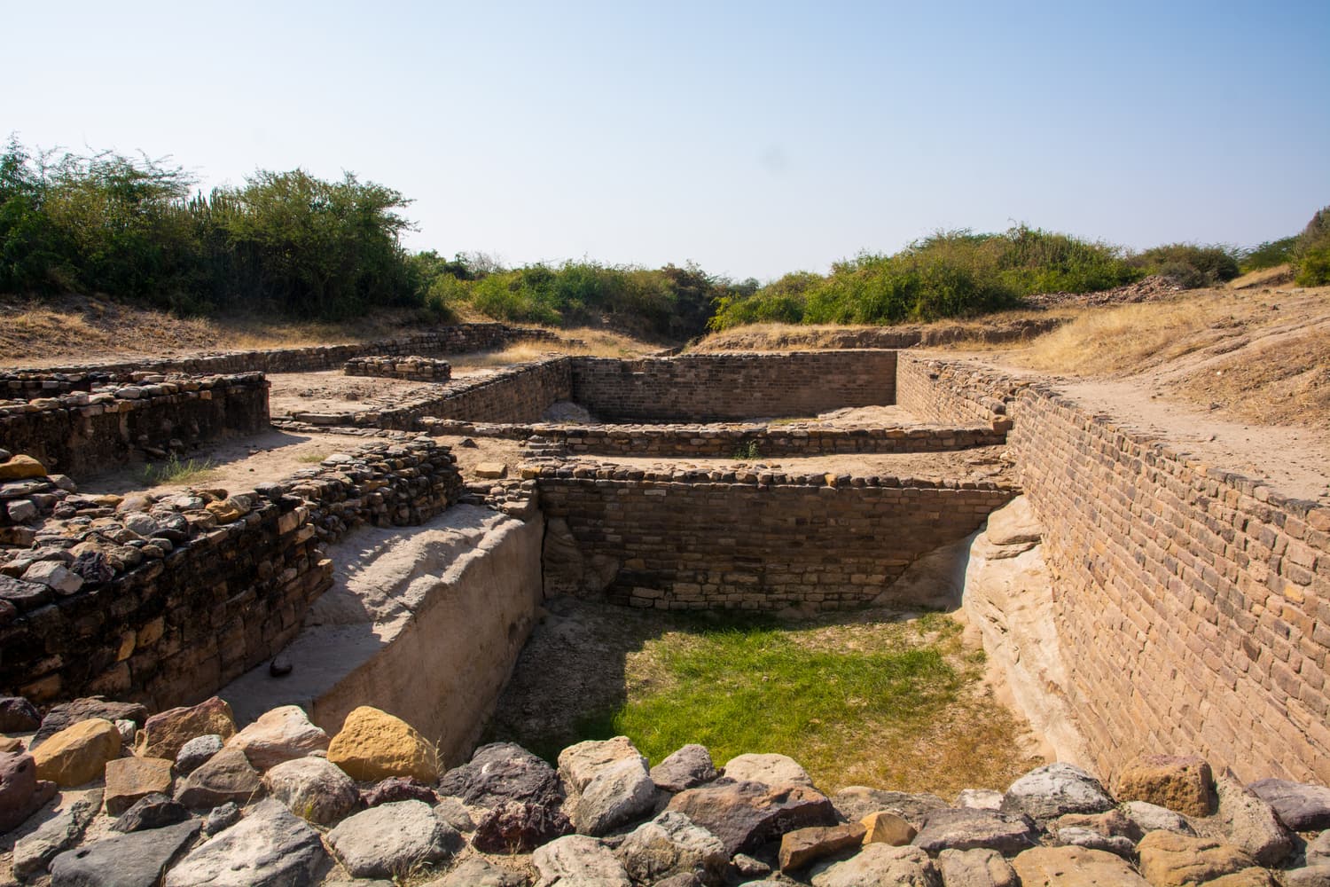
A chain of great tanks cut into rock and lined with stone around three sides of the city, fed by dams on two seasonal streams and by rainwater channelled off the citadel. The stepped eastern reservoir is the single most impressive thing at Dholavira and one of the oldest large water works anywhere.
 The Harappan city
North Gate, Signboard & Stadium
Ten Indus signs and a ceremonial ground the length of three football pitches
The North Gate of the castle is where excavators found ten large Indus-script signs — often called the world’s oldest signboard. It opens onto a long ceremonial ground with stepped stands, the open space between the rulers on the citadel and the townspeople below.
 Khadir Bet & the Rann
Road to Heaven
A dead-straight highway across the white Rann to Khadir Bet
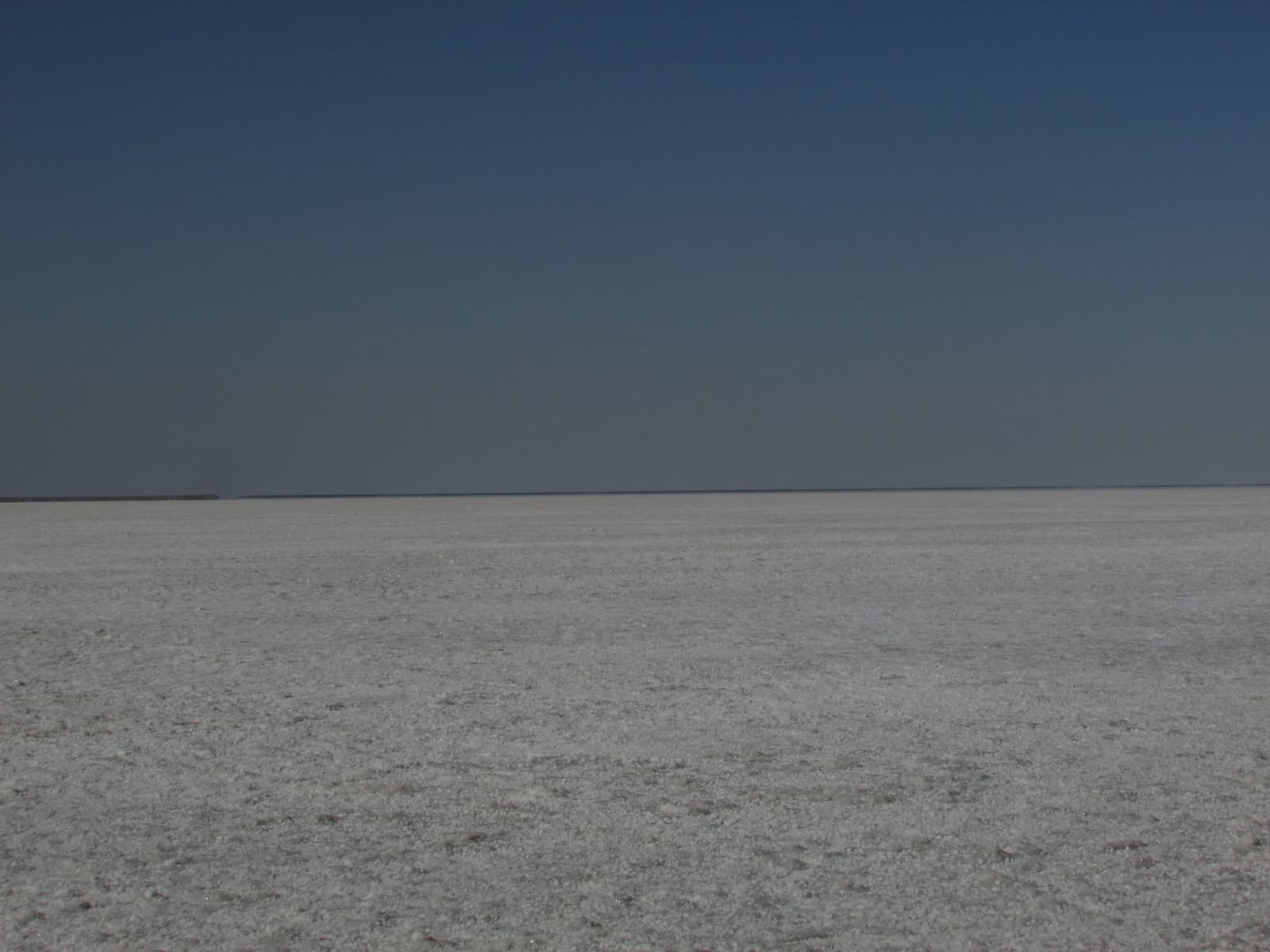
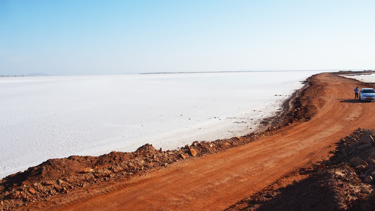
The stretch of the Ghaduli–Santalpur highway that runs for about 30 km across the open Rann between the Khavda side and Khadir Bet — salt-white in winter, a shallow sea after the monsoon. It has cut the journey from Bhuj to Dholavira roughly in half and become an attraction in its own right.
Practical information
Opening hours and fees
The archaeological site is managed by the Archaeological Survey of India and is normally open every day from sunrise to sunset. The museum keeps shorter hours and, like most ASI museums, usually closes one day a week (commonly Friday). Entry charges have been low or nil at different times; carry cash and ask at the counter. We deliberately do not print figures that we cannot keep current.
Guides
Signage on the ground is limited. Local men who worked on or grew up beside the excavation act as guides and wait near the entrance; a good one transforms the visit. Agree a fee before you start. Hindi and Gujarati are standard; English is more variable.
Heat, sun and safety
- There is almost no shade. Even in winter, wear a hat and sunscreen and carry at least a litre of water each; from March onwards, much more.
- From April to June daytime temperatures commonly pass 40°C and can approach 45°C or more. Visit only in the first two hours after sunrise or not at all.
- Reservoir edges are sheer and unfenced. Keep children close.
- Wear closed shoes: the ground is stony, with thorns, and snakes and scorpions live here as they do in any dry country.
- The nearest hospital of any size is in Rapar or Bhuj. Bring any medication you need and a basic first-aid kit.
Money, food and connectivity
Bring cash from Bhuj or Rapar. Meals are available at the resorts and at a few simple places in the village — expect vegetarian Kutchi and Gujarati food: bajra rotla, kadhi, khichdi, buttermilk. Gujarat is a dry state and alcohol is not served. Mobile signal comes and goes; Wi-Fi, where a resort offers it, is slow.
Respect for the site
Do not climb on walls, move stones or pick up potsherds, beads or fossils. Take all litter away. Drones need official permission. Villagers are hospitable and unused to crowds: ask before photographing people.
What to pack
- Hat, sunglasses, sunscreen and a scarf for dust.
- Sturdy closed shoes.
- A warm layer for winter nights and dawn — the desert gets cold from December to February.
- Water bottles, snacks and rehydration salts.
- Torch, power bank, offline maps.
- Photo identity for everyone; passport and visa for foreign nationals.
- Binoculars if you care about birds.
Beyond the ruins
On Khadir Bet itself, drive out to the Fossil Park and watch the sun set from Chhipar Point. On the way in or out, cross the Road to Heaven slowly. In the wider district, give time to Bhuj, the White Rann at Dhordo, Kalo Dungar, the craft villages and Mandvi.
Flamingos and other wildlife
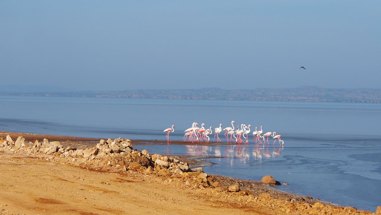
The Great Rann is one of the few places in South Asia where flamingos breed, on mud flats far from any road that are off limits to visitors. What travellers see are feeding flocks, which spread across the shallow water of the Rann after the monsoon. In a wet year, from about October to February, they can often be watched from the Road to Heaven and from the rim of Khadir Bet; in a dry year the water — and the birds — may be gone by December. Chinkara, desert foxes, nilgai and many birds of prey also live on and around the island.
Sample itineraries
Two days from Bhuj
- Day 1: Bhuj → Kalo Dungar → Road to Heaven → Dholavira. Fossil Park and sunset at Chhipar Point. Night at Dholavira.
- Day 2: the ruins at opening time, then the museum. Drive back to Bhuj by early afternoon.
Four days in Kutch
- Day 1: Bhuj — Aina Mahal, Prag Mahal, Kutch Museum, sunset at Smritivan.
- Day 2: Bhujodi and Ajrakhpur, or Nirona; on to Hodka and the White Rann at Dhordo for sunset. Night near the Rann.
- Day 3: sunrise on the salt; Khavda and Kalo Dungar; Road to Heaven to Dholavira for sunset.
- Day 4: the site in the morning; return to Bhuj, or leave east via Rapar.
A week from Ahmedabad
- Days 1–2: Ahmedabad; Modhera and Rani ki Vav; on to the Little Rann of Kutch.
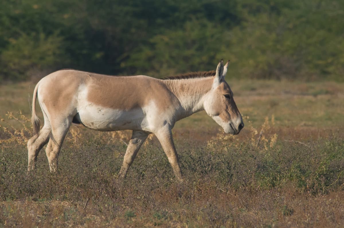
- Day 3: morning safari for wild ass; drive via Rapar to Dholavira.
- Day 4: the ruins; Road to Heaven and Kalo Dungar; night near Dhordo or in Hodka.
- Day 5: White Rann at sunrise; craft villages; Bhuj.
- Day 6: Bhuj, or a day at Mandvi.
- Day 7: fly or take the train out of Bhuj.
If you would rather have it arranged, see the tours page — and note which of them actually include Dholavira.
Combine your trip
Many visitors pair Kutch with Saurashtra, the peninsula to the south. Our Gir National Park travel guide covers the last wild home of the Asiatic lion, with its safaris and online permits. Sasan Gir is roughly 400–450 km from Dholavira by road, usually via Rajkot, so it works best at the start or end of a longer trip around Gujarat. Gir’s safari season usually runs from mid-October to mid-June, which overlaps well with the cooler months that suit Dholavira.